Finding Beauty with Imperfection

Category: Hiking Page 1 of 5

Zion National Park

Well, our week of good fortune continued. Dave and I entered the daily lottery to obtain a hiking permit for Angels Landing. And we BOTH won!! Woot woot! off to Zion we go!!

Our drive took about an hour and 10 minutes. The views of course were spectacular. Part of the drive includes driving through a 1.1 mile tunnel. The tunnel has several windows from which you can catch glimpses of the park. Stopping is not allowed in the tunnel… however, being the off season, no one was behind us and so Dave stopped so I could snap pictures out our windows.

After coming out of the tunnel, you descend down to the canyon floor using 6 switch backs. The views are incredible especially as the sun was coming up on the mountains.

At the bottom of the canyon were several mule deer doing their thing.

Deer Friends

We parked and got set for the hike. It was 32 degrees and windy as we set out to hike. Angels Landing is a strenuous 5.4 mile (almost 6 for us). It took us approximately 4 hours to climb making us average hikers according to the warning signs. Ha!

The first 2ish miles of the hike are mostly paved with a series of 21 switchbacks known as the wiggles. Anyone can hike this portion of the trail which brings you to Scouts landing.

We reached Scouts Lookout in about an hour. Our quads were feeling the burn! There are signs posted frequently to remind you permits are required to hike the Angels Landing portion. To reach Angels Landing requires climbing a trail cut into stone. It is not a trail for the faint of heart. The total elevation change is 5790ft. This section is only about a mile round trip. It was the most challenging mile I have ever hiked.

The temperatures warmed up now that we were in the sun, but it was still windy. Along the trail are sections with chains to help you climb. There are also sections without chains. Both were super scary.

There were times when the space between steps were too far for my legs. I not only used all fours to climb but sometimes my knees and butt. The trail wasn’t crowded on our way out and the weather was perfect. The wind seemed to die down as well. Whenever we had to wait for someone to pass, I would take a break, sit and enjoy the view.

At the Saddle portion of the hike we saw a condor perched on top of one rock.

California Condor

It took us about an hour to climb the to Angels Landing. Slow and steady. I’ll admit, I had moments where I was completely freaked out by the height. I did a lot of deep breaths and reminded myself to take it one step at a time. Dave was an amazing hiking partner, of course. He was patient and so supportive. We developed a system where we would only have one of us on a section of chain at a time because the chain would wiggle and freak me out!

We packed sandwiches and stopped for lunch on top. Talk about a view!

While we tried to relax, we had annoying chipmunks begging for snacks.

Go away!

After about 30 minutes we were ready to hike back down. Just a few more pictures to truly take it in.

We also joked about the trees along the trail. Tree friends were a favorite of mine to hang onto and in some cases hug! I also loved when there was a crevice I could wedge myself in as I climbed up.

It took us about an hour to climb back down to Scouts Lookout. It was easier in some ways to descend because the physical demand was less. However, perspective wise, it was more challenging because now my back was to the mountain and I saw more of the open space all around me. It gave me that vertigo feeling. Also, we had to wait more frequently because the trail was getting more crowded. When we made it back to Scouts Lookout we took a picture of where we just were. If you look closely, you can see people on Angels Landing on the left side of the red rock.

People on the left
Zoomed Out View

It took us another hour to hike down and back to the car. We took our time down the switchbacks reflecting on the hike we just conquered!

After our hike we drove through the rest of the park. Soaking in the majestic view of the huge mountains. Most of these pictures were out of the car window. Beautiful regardless.

This week has been truly epic! Beyond my expectations. Thank you for following our adventures.
Bryce Canyon National Park

We started out early for our adventures in Bryce Canyon NP. Not because we needed to avoid the heat or crowds, but because we wanted to catch sunrise. Fortunately it’s winter and sunrise is at 7:26 here. We are about 1.5 hours from the park and left our Airbnb at 5:20. We arrived in plenty of time and had the Sunrise Point pretty much to ourselves. Mainly because it was 15 degrees and windy. Not too many fools chase a winter sunrise! It was incredible and completely worth it.

Hoodoos with snow!
The amphitheater looking like it was on fire!
Mother Nature is amazing!

After sunrise, we returned to the car to warm up for a minute or 10. We decided to adjust our plan for the day. Instead of starting with a hike and ending with the drive through the park, we started with a drive to let the temperature warm up. At the beginning of our day we had the park to ourselves. There were no cars in any of the park spaces and we saw so several deer running.

Deer Friends

For our drive, we downloaded the guided tour for Bryce Canyon and Zion from the GuideAlong app. I highly recommend the app. It uses your location to tell you all about the points of interest. We learned so much about the park! We drove to the end of the road and started at Rainbow Point. Rainbow point has the highest elevation at 9115 feet. There was a little bit of snow cover making the Bristlecone Loop trail inaccessible to us.

We continued our drive down to Black Birch Canyon (8750 ft). We named the narrator of our GuideAlong tour, Alfred. He is kindof funny. He shares facts and also points out when things are miss named. Like Black Birch Canyon because there are no birch trees in the park! It’s was beautiful regardless it’s name.

Our next stop was Ponderosa Point (8904 ft). Here we learned all about Ponderosa Pines. It is often used as building material because it doesn’t swell or shrink after processing. Also, it has a delightful odor.

Agua Canyon was our next stop. The sunlight on the hoodoos really created dramatic photos.

As we continued down, we learned about prairie dogs. Unfortunately, even though they are all over the park, they are hibernating because of the cold temperatures. We took a stop at Natural Bridge (8627ft). Here again, Alfred told us of the miss naming. It’s actually not a bridge but an arch. Bridges form from flowing water. Arches form from wind and rain erosion. Whatever you call it, it was beautiful.

After Natural Bridge was Farview Point (8815ft). Alfred did mentioned this name was appropriate. We took a short little hike here to drop slightly below the rim. The change in viewpoint was stunning.

Finally, we made it to Bryce Point and Inspiration Point (8300 ft). And oh, man! I was in complete awww. I have never seen anything like Bryce Canyon. The beauty was so incredible I had tears. I have seen a lot of things in my life and I’ve seen pictures of Bryce Canyon, seeing it in person is surreal. I know my pictures don’t capture the beauty, I hope you enjoy them regardless.

We loaded up in the car and made it to Sunset Point. Again, wrongly named because it faces east not west. The Ranger told us the Wall Street section was open! Yay! Off we went! We hike the Queen Garden Trail to the Navajo Loop Trail. It was so fun to get up close to the hoodoos. They are such a marvel.

The total hike was almost 3.5 miles. It was lovely. The temperature was perfect. We commented several times how fortunate we have been with the weather this week. Not to mention missing the crowds. It would be a completely different experience to do these hikes in the heat and crowds.

A special thanks to Dave. He was such a good sport, as always, to chase a sunrise with me. And to you- thanks for reading.

Grand Staircase Escalante

Tuesday we booked a tour of The Grand Staircase Escalante. The Grand Staircase Escalante National Monument is a 1.7 million acre (slightly larger than the state of Delaware) remote area requiring a four wheel drive vehicle to travel the dirt roads. It is one of the most remote areas in the country and the last to mapped in the lower 48. We were at the top “stairs” with the bottom of the staircase being the bottom of the Grand Canyon.

During wet weather, the roads can be completely impassable. The road was a bumpy washboard with deep ruts and crossed several streams. However, it was totally worth it, the area offers some of the most breathtaking views of the state’s colorful sandstone cliffs and narrow slot canyons.

We started our tour at 8am and our first stop was a breathtaking vista overlooking the cliffs.

Our second stop was at Bull Valley Gorge. Here we could view a slot canyon from above. Stuck in the canyon was a 1950s ford pickup truck. The legend goes, high school kids were in the canyon when a flash flood came through. Their truck was unable to travel up the muddy sides of the canyon and became caught in the flood. The kids survived. No doubt they got a good whooping!

We continued to drive down the mountain and arrived at Willis Creek. We walked down the icy creek to view the slot canyon. It was incredible.

We booked our tour through Dreamland. (Same organization as our Wave Hike) Our tour guide was Jaron. He was fantastic. Not only an excellent driver, also a superb photographer and very knowledgeable about the area.

We continued our journey and arrived at Kodachrome Basin State Park. Here we enjoyed a picnic lunch before hiking up to Angels Palace. It was a short hike to the top of the rock formation to view the sand spires and get a panoramic view of the basin. The park has 67 sand spires ranging in a variety of sizes. Big and small. So many jokes about all of these phallic features. The views of the different staircase steps was truly breathtaking.

Our next stop was at the sandstone rock formation, Grosvenor Arch. It is located is in the western corner of Grand Staircase-Escalante National Monument. The arch is named after Gilbert Hovey Grosvenor, president of the National Geographic Society, the publisher of the National Geographic magazine. The arches were a mix of Henrieville Sandstone (165 million years old) and Dakota Sandstone (95 million years old). Weathering created a stunning natural marvel.

We continued on to the Cottonwood Narrows and took a short hike down into the slot canyon. It was unreal to see the size of boulders that are moved by flash flood waters.

I couldn’t get over the different rock colors. They seem so random.

As our tour came to a close, we made a couple more stops. One of them to see the mushroom hoodoos. It was another short hike to observe them from above. Can rocks be cute? These sure were!

Our final stop was close to Kanab. This vista was absolutely stunning.

Throughout the day, we encountered only one other group of explorers and passed maybe 5 cars. The area was gorgeous, quiet and completely mesmerizing. We obviously didn’t see the entire 1.7 million acres, but what we saw was captivating and made my nerdy science heart so happy. As always, thanks for reading!

The Wave

The Wave, properly know as Coyotes Butte North is a geological phenomenon. It is located in an area of Utah/ Arizona as the Vermillion Cliffs. The area is protected by the US Bureau of Land Management (BLM). In order to hike The Wave you must obtain a permit from the BLM.

You can enter the lottery three months in advance or one day in advance. Only 64 people per day are allowed in the area and as a result, demand far exceeds supply. Obviously, December isn’t a high demand time for hiking and so obtaining a permit is a little bit easier. Nonetheless, it requires a little bit of luck. And as the saying goes, sometimes it’s better to be lucky than good!

Dave, the lottery winner

Dave, as always, was the lucky one. He won the lottery for the four of us. We found out in early September he won and have been planning this adventure since then. There is no true trail to hike to The Wave. It is about a three mile hike to it through a desert landscape. We decided to hire a guide for peace of mind and safety. We were beyond happy with the decision. Our guide, Andrea, was very knowledgeable about geology and photography. Besides The Wave, she showed us dinosaur tracks and artifacts. Without further ado, here are our amazing pictures.

The formation of the Wave began 190 million years ago during the Jurassic Period. The desert dunes compacted and solidified into striped sandstone. The peculiar and unique fluctuating layers were created by slow wind and rain erosion.

Not to be ignored was the beautiful desert landscape as we hiked.

The dinosaur tracks were definitely a highlight along the way. because science is cool and real.

The hike to and from was beautiful. Although not as challenging as some hikes we have completed, it was the first we have ever witnessed an emergency situation. We stopped for a drink of water right before the last climb to the wave. While we were resting a group of four passed us. Not even 10 minutes later, as we were packing up to continue, we heard a scream. Turns out one lady in their party slipped and broke her ankle. We provided assistance and so did a BLM volunteer who was nearby. In the end, she had to be medically evacuated.

Andrea showed us evidence of ancient civilizations. What looks like just a rock is actually a mealing stone.

I would highly recommend adding The Wave to your bucket list. It truly was a once in a lifetime experience. Unless you’re a guide like ours, Andrea has hiked it over 100 times!

As always, thanks for reading.

Vegas to Kanab

Sunday morning Dave and I enjoyed a quieter morning and enjoyed visiting the atrium of the Bellagio without the crowds. The Christmas display is completely over the top. Like everything else in Vegas!

After breakfast, we packed up and returned to the airport to pick up our rental and our friends! And so our road trip began!

First stop Valley of Fire State Park. Nevada’s first state park.

Valley of Fire State park is about an hour away from Vegas. Within minutes of entering the park we had our first spotting of wildlife. Big Horn Sheep!!

The red rocks are caused by the oxidation of the iron in the rock. So, basically they are rusty rocks. The black is caused by the oxidation of manganese in the rock. Our first stop in the park was to see the beehives. The holes and ridges in the rocks are caused by erosion.

We continued driving through the park. We entered through the west entrance and exited through the east entrance. It would be easy to spend an entire day in the park. We only took a couple short walks to see specific sights. Mainly because we still had a three hour drive ahead to Kanab.

We stopped to see a petrified log…

We stopped to see elephant rock.

Elephant rock

We loaded up in the car and continued our drive to Kanab. The drive was beautiful. We crossed back and forth from AZ to UT.

The sunset as we crossed through the Kaibab Indian Reservation in AZ. It was stunning.

Sunday Sunset

We were glad we hit the road when we did from Valley of Fire State Park. We didn’t realize we went to mountain time in Utah. Our three hour drive was actually four. We were hungry and still needed to gather provisions for Monday’s Wave hike. Our hike begins at 8am. We are all beyond excited!

Hiking Oia to Fira

Today was our third official hike day. We had a transfer scheduled to pick us up at 9am at our hotel. Before we left, we enjoyed the breakfast at the hotel. It was delicious and had a little bit of everything. Including normal scrambled eggs, stuffed grape leaves, mushrooms and of course feta.

Yummy

Our driver picked us up in his fancy Tesla. We chatted during the drive to Oia. Turns out, he is a former Greek Navy Seal (retired). He trained several times in San Diego. He was very nice and encouraged us on our hike. Oia was chaos. It was incredibly crowded with everyone wanting to get the perfect picture. Plus, there were multiple women doing photo shoots and clogging the paths. We honestly just wanted to snap our pictures and get on with our hike. Here are a few from Oia. It is beautiful and stunning. I just could do with out the crowds.

Here are my favorite doors from Oia.

Here was the crowd, waiting to get “the” shot of the three domes. Also, I took a picture of the lady who was causing the line. And then I photoshopped her out. It was a quick edit. I’m sure I can do better.

I would also like to share my pictures of the cats of Oia. So cute.

Most of the hike was along the top of the ridge. However, there were a lot of ups and downs. And lots of stepping on igneous rocks. They are so sharp and pointy. They really started to bother my feet towards the end. Here are a couple up pictures of the trail.

I’m not sure I’ve mentioned, we booked our trip through Macs Adventure. They have truly been amazing. All hotels, transfers and ferries have been prearranged. Also, they put everything on an app that is easy to access. The app includes maps of all your hikes. Here was our map for today.

Once you start hiking, it will track your journey and give you alerts for upcoming points of interest and way points. If you’re looking for a guided trip, we highly recommend. We would both consider booking another adventure. Ok, let’s continue. The east side of Santorini is so different from the west. Here are a few pictures looking down at the farm land on the east side.

I would also like to share my favorite bougainvillea pictures from the day. I’m so inspired, I want to plant one when I get home!

There were so many churches along the route. They are striking with the blue domes.

The buildings and flowers were beautiful. It was also incredibly peaceful walking above the caldera. We were so high up!!

Humor me with a couple more doors.

The middle section of the hike was through a bunch of fancy hotels. Most said no pictures and do not enter. The view remained incredible.

The highlight of any hike is the cold beer at the finish line. The finish line for this hike was conveniently our hotel. We came back and showered before our well earned beer. Cheers!

We picked a nice local spot for dinner. We watched the cruise ships boarding passengers as we dined.

As always, thanks for reading. We have our last adventure tomorrow. We are sailing on a catamaran in the caldera!

Hiking Kimolos Island

We started our day with a 6:30 taxi ride to the Pollina Marina to catch the 7:15 ferry to the island of Kimolos. Once we arrived we were hiking by 8:00am.

The first part of the 9.5 mile hike was around the fishing village of Goupa. Goupa is an old traditional fishing village. The old sea caves / cliffs have been converted into garages. In many places the waves were right up against the doors. The views were stunning in the morning sun. It truly feels like you’re walking through a time capsule. There are no vendors, stores, cafes or anything catering to tourists.

The trail did get a little tricky to follow. Fortunately, someone got tired of people coming into their yard and painted the way!

We continued along the water until it was time to start the climb! Whew! Was it ever a dusty climb!

A couple facts about the island of Kimolos. In the 2021 census, there were 810 residents. Only about 600 stay during non tourist season. Also, there are 80 churches and chapels on the island. We didn’t have time to see them all… but here are a few.

A few fun pictures and cats from the hike.

The goal of this part of the hike was to see Skiadi. Skiadi is a natural rock monument that resembles a giant mushroom. It is location high in the hills means there’s often strong winds, and the softer rock at the base erodes quicker than the harder rock above. Due to its size and shape, it’s catalogued in the Atlas of Geological Monuments of the Aegean. Without further delay I share with you Skiadi.

Skiadi

We were a slightly underwhelmed. But made up for it by taking silly pictures. We sat in shade and ate our snacks before heading back down. The little lizard wanted to be friends.

The views of the sea were breathtaking.

If you decide to take this hike. Do the first part and have someone drive you up to the trail for Skiadi. You can skip the climb and it would be about 1.5 hour round trip. You won’t miss much….

Nonetheless, we had fun. We walked through the heart of town and enjoyed ice cream. And then finally the finish line beer! Well earned!

We boarded the 4:30 ferry back to Milos. We enjoyed dinner at a spot recommended by our driver Yiannis. It was delicious. Snapper and Grouper.

A few last shots of the marina. Check out the ink draining from the octopus!!

Yiannis picked us up and asked if we had time to stop at Sarakiniko Beach. Sure! Wow! Talk about a lunar landscape. According to Wikipedia, this is the most photographed beach in the Aegean Sea. Definitely not hard to see why!

Thanks for reading. We had a full day! Tomorrow we take a break from hiking and go sailing!

Crested Butte, CO

Sunday morning we were up early and packed up by 9am. We wanted to hike the Snodgrass Trail in Crested Butte. George and Juliana hiked this trail two summers ago and highly recommended it. Their directions to find it left us doubting we would. “Drive through town and follow the road until you see a parking lot with a port-a-potty.” Sounds sparse, right? Actually, they were spot on! we spotted the potty, found the trail we wanted to take and set off!

After reading AllTrails, the hike was 5.8 miles. We packed water and snacks and set out. Ironically, the AllTrails map took us to the top of Snodgrass Mountain. The trail Sadira is pointing to in the picture above is what we walked for about a mile before realizing we weren’t on the trail. Our 5.8 mile hike turned out to be 8 miles! The views were amazing! Wildflowers and Aspen and of course Crested Butte.

Sierra larkspur & Crested Butte
Aspen
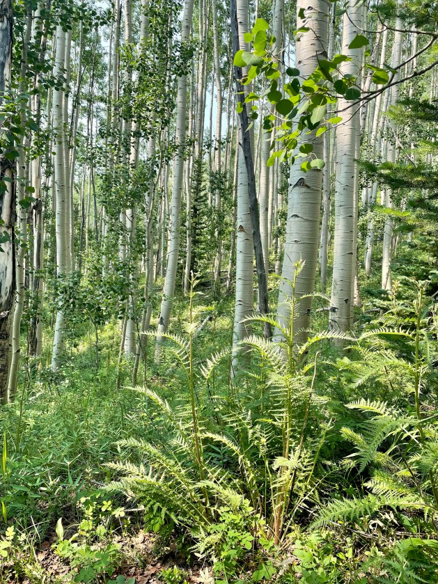
Aspen and ferns
Flower Friends
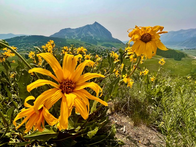
Arrowleaf Balsamroot & Crested Butte
Lichen

Once we realized we weren’t on the summit trail, we turned around and started up the mountain. Everyone knows the reason you hike a mountain is for the panoramic view at the top. Hopefully. We hiked up about 1.2 miles in what seemed like straight and steep uphill. In the sun. Only to find the top was covered with pine trees that obstructed the view.

The view at the top
Taking a breathe break at the summit

Regardless, it was a great hike and a quick walk down. More Aspen, butterflies, and flowers.

Crested Butte on your head!
Callippe fritillary
Wood betony & Aspen
Crested Butte

After the hike, we hopped in the car and started the drive over to Redstone Campground. It was about a 2.5 hour drive. We had to go up & over the mountains using Keebler Pass. Little did we know the drive was mostly (40 miles) on a curvy gravel road. It was awful. Sadira was car sick by the time we got over it. We stopped at a little campground and had a snack while watching the hummingbirds until she was feeling better. Whew! What a drive!

Saturday was the only night we’re stayed at a KOA. Camping life in a KOA campground is much different than camping life in a National Forest. The perks of a KOA include showers, laundry and flushing toilets. Oh! And a dishwashing sink that ONLY has hot water. To enjoy those perks you pass up seclusion, privacy, and incredible views. Sunday night we were in Redstone Campground. It was appropriately named – there were red stones all around us! We had privacy, scenery and clean pit toilets!

I forgot to snap a picture of our meal. Sadira made us pimento grilled cheese and tomato soup. It was delicious. We took a dip in the creek and then had a solar shower… our last one, actually… more on that tomorrow-

Cheers!

Gunnison, CO

Our drive to Gunnison, CO on Saturday was about three hours. We had lunch on the road and arrived at the Gunnison KOA right at 2:00pm for check in. We were so late to the party planning this adventure this was the only campground I could find for Saturday night. Honestly, it wasn’t terrible. We had a real shower, flushing toilets, and laundry facilities. It was a good reset for the halfway point. From one perspective it looks like a KOA. From the opposite perspective it looks perfectly pleasant.

Campground Chef in a crowded KOA
It’s like we have the place to ourselves

After checking in, we went to Hartman Rocks for a short desert hike. We really pushed the Prius to its uphill limits. This area is filled with mountain bike trails and the road was super rutted. We decided not to push the limits too far and hiked around from the first parking lot.

Adventure awaits
Rocks
That view!
Lichen
Champion

We saw several great wildflowers over the past two days on our hikes. Here are my favorite.

Plains Prickly Pear
Spineless Horsebrush
Sego Lily
Arrowroot Balsamroot
Scarlet Gilia
Rocky Mountain Penstemon

The hike was hot with a nice breeze. We decided a short hike was best to keep us from a visit to the hydration station. We went back to the campground and enjoyed not having neighbors- until they arrived after we went to bed. Speaking of the campground, we decided this would be a great opportunity to rack up some license plates. As we walked around, we added an additional 5 plates to our collection. Bringing our total up to 43! #strongwork

Campground Chef – burritos

Taos Take 2 & Elk Creek

Friday morning we drove back to Taos for a very important mission… Fun Rings! As we drove down the mountain, we got stuck behind the line marking truck. Painfully slow trip down most of the mountain!!

We made it to Taos, finally. After a quick stop at the Walmart for fizzy water, ice, and pimento cheese, we walked through the Taos plaza on our ring hunt. The second store was a huge success. A fun silver and turquoise ring for each! The lady who helped was super nice and warned us of bears while hiking. She suggested we carry a knife. ??‍♀️

Fun Rings!

A few of my favorite pictures from our walk around Taos.

Friendly reminder in Taos, NM
Catching fish

We fixed pimento cheese sandwiches for lunch and were back on the road. Our next destination was Elk Creek Campground near Antonito, CO.

Elk Creek

We had no cell service in the campground. It was kind of fun to fall off the grid. We decided to take a hike. The skies were overcast and the temperature was in the low 70s. We thought it might rain while we were hiking. Luckily, the rain held off and danced around us. The hike was lovely.

Cool Tree
Rain Clouds
Hiking in Aspen

After our hike, we set up camp and made a gourmet dinner of tortellini and sauce. We also had a chance to try out the portable shower. It was cool and refreshing. We had to layer up because the mosquitoes were really bad. But, with cool dry nights in the upper 40s layers were good!

The next morning, we relaxed and didn’t leave camp until 10ish because we needed to stop at the visitor center to use their wifi to get directions. As we were sitting there, the nice host – who told us about the hike the day before politely ease-dropped on our conversation. When I said we needed to head back to Antonio, he replied, “That’s cute. It’s Atonito.” We had a good laugh. Me especially, because I’m notorious for mispronouncing places.

Saturday morning camping vibes

With another bag of ice for the cooler, we were off for Gunnison, CO.

Page 1 of 5

Powered by WordPress & Theme by Anders Norén