Finding Beauty with Imperfection

Category: Miura Peninsula

Buddha and Sakura

Friday morning Cindy and I started our day with a visit to the Great Buddha of Kamakura. Of all the places we visit on a Julia Tour, the Great Buddha of Kamakura is my favorite.

It takes about 45 minutes on three different trains to get to Hase Station. From Hase Station, it is about a ten minute walk to the Great Buddha. I enjoy the trip with my first timers because we ride three different train lines: Keikyu Line, JR Line, and the Endoshima Electric Railway. The Endoshima Electric Railway very popular and even has its own emoji ? !

The Great Buddha of Kamakura Temple is beautiful. Even on our cloudy morning, the Great Buddha was impressive.

At times, the Temple can become quite crowded with tour groups.

Typically, the tour groups don’t stay very long. If you’re patient enough to wait for them to leave, you can experience a more serene environment and the opportunity take a few photos without too many people.

No trip is complete without a visit inside the Great Buddha. For ¥20 (20 cents) you can enter inside “Buddha’s Pooper” (a phrase coined by Bill Johnson during his visit).

Once we made our wishes and collected a temple stamp for Cindy, we took the train back to Kamakura. I left Cindy on Komachi Dori, the main shopping street in Kamakura, while I went to my English class. I was so proud of her for handling two hours solo in Japan! After my class, we met up and decided to go see the Sakura blossoms on the Miura Peninsula. Normally, we would visit the Tsurugaoka Hachimangū Shrine as part of our Kamakura day. However, we decided to save that visit for Sunday and seize the opportunity to see blooming Sakura trees.

We hopped on the train and away we went! From Kamakura we went back to Zushi and then down south to Miurakaigan where a special species of Sakura blooms very early.

The trees were not quite at peak bloom. They were gorgeous nonetheless. I’m glad we waited until the afternoon to visit. The pink flowers look beautiful against the blue skies.

We walked along the tracks for a little bit. I wanted to take Cindy to the bridge that crosses the tracks and provides a great vantage point for photographing the Sakura and passing trains.

As we walked back to the train station, we snapped a few pictures along the way.

As the sun set on our fun Friday, we met Dave for dinner in Yokosuka. We took Cindy to our favorite Korean BBQ restaurant. We cooked dinner over the hot coals and shared our days adventures. We all agreed to calling it an early night. Saturday we are taking the ITT trip to see the Snow Monkeys. We have to meet the bus at 3:30am. With a 2:30 reveille in my future, I’ll say goodnight for now!

Koajiro Forest

Trip Advisor helped Katie discover a hidden gem on the Miura Peninsula known as the Koajiro Forest. It was so obscure, I had trouble locating it at first on Google Maps. We knew we needed to take the Keikyu Line train to Misakiguchi, the last station on the Miura Peninsula. From there, the route was a bit unknown.

As we rode the train, we passed the Miurakaigan Station. This area has a Sakura Festival that I went to last year around this time. I was hoping the blooms were a little delayed this year so I could take my sister-in-law next week during her visit. Luck is on our side! The blooms are not full yet. I think next week they should be in peak bloom!

To find the Koajiro Forest, Katie and I boarded bus number 26. We knew we needed to travel about 5 minutes or 3 stops. However, buses are tricky. If no one pushes the button to stop and no one is at the actual bus stop, the bus will keep going. Fortunately, we were paying close attention to the blue marker on Google Maps and to the marquee at the front of the bus. I pushed the button alerting the driver to stop. We exited at the correct stop which was actually only the second stop. So far, so good.

We started our walk and followed the blue dotted line. We made sure to pay attention especially when the road forked. At one point we were walking down a road through a bunch of farm fields. But, it seemed ok because it was obviously a road.

We kept following and eventually ended up in the middle of a farm. At this point we were feeling a bit lost. The road ended and all we had was a trail around a cabbage field with a steep ravine on the far side.

We commented how thankful we were that the Japanese don’t own guns because we felt like trespassers. We turned around to attempt to locate where we made a wrong turn. (And simultaneously cursing Google Maps). As we turned a farmer yelled to us (not at us). I approached him with my phone and showed him this picture.

He did a cute little hop to see my phone and then with a happy smile gestured for us to follow him down another little trail along a different cabbage patch. We followed him for about a minute before reaching the top of the trail head leading down to the entrance to the forest.

Wow! Arigatōgozaimas!! We said with much enthusiasm about 5 times and bowed just as many. We again commented about how kind and helpful the Japanese are as a whole. And also laughed at how in Japan it’s no big deal to follow a man you don’t know into a forest. As we approached the entrance, we saw a map of the park and a picture of crabs. The Science teacher in me became very excited.

We continued our walk and came across the flatlands. It felt good to get into the sun. It was very windy along the water.

Unfortunately, we didn’t see any crabs. Too cold. We considered this a good scouting mission! We came across this sign of the tidal wetlands and I got a little Science dorky again. Katie and I both agreed this area reminded us of Sea Shore State Park in Virginia Beach.

The wetlands were so beautiful and we imagined they would be even more beautiful in the spring. We look forward to returning in a couple months.

We continued along the raised walkway. The forest was fantastic.

Here’s something that made us giggle. This was the map we saw down by the tidal area. We were getting ready to follow the yellow path from the “you are here” spot to the right.

I took this picture a little further up the path. Notice the water is now on the right and we are walking to the left! Fortunately, both signs were in English and the path was along a raised wooden walkway. We really couldn’t get lost.

Today was a beautiful sunny day and although a little chilly, it was a great day to explore. I honestly can’t believe how many beautiful areas of Japan there are hidden in plain sight. We truly are fortunate to live here and have time to explore!

Mt. Miurafuji Hike

Katie has asked me about different hikes near base that would be good for her to do with her kids on the weekends. I remembered the hike of Mt. Miurafuji and Mt. Takeyama I did last March. We decided to go today because the weather was clear and not too cold. We met at Yokosukachuo Station. It was our lucky day because we were on a yellow train! Usually, the Keikyu Line trains are red. Very rarely there will be a blue, white or yellow train. When this happens, I get very excited and consider it a lucky day!

We started our hike at the Keikyu-Nagasawa station. It was different than where I started last time, but I knew it would be closer to the trail head. We walked past a bunch of farms. They were full of winter vegetables. Cabbage, cauliflower, kale, and daikon (Japanese radish).

As we were walking towards the trail, we passed a couple of older Japanese ladies. They stopped us and asked us if we lived close. Yes, Yokosuka. They asked if we were going to hike Mt. Miurafuji. Hai! They then became very animated gesturing at our sneakers. We said we would be ok and then asked us to please be careful. Hai! Arigatōgozaimas! We continued on our way and found the trail head without trouble. The trail head is marked with a Torii located behind a school.

And then we began our ascent.

But, the view from the top of Mt. Miurafuji was worth it! We were able to see Mt. Fuji!

Our summit selfie.

We continued along the path. We were chatting away and taking our time descending.

I knew to look for a specific fall rock sign from the last time at an intersection. 
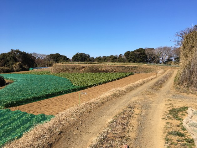
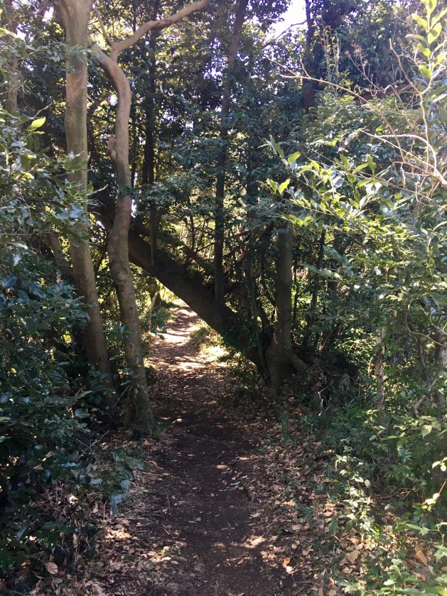
Unfortunately, when faced with the choice to go right or left, I choose left. The trail led us back down the mountain. I should have gone right. I thought the trail to the right was only a dead end. It does have a dead end, but it also is the connection to Mt. Takeyama. I knew something wasn’t right when we were back so quickly to the farms and plum blossoms.

When I got home, I looked at the map a little closer and realized the error of my navigation. Here is the map of the area.

We took the path in yellow. We omitted the portion in blue.

It would have added another 30-45 minutes to our hike. It would have been nice to see the other view. However, by the time we walked down and back to the Tsukihama train station, we were both ready for lunch. Another 30-45 minutes might have pushed us over the top! I sent my marked up map to Katie so she can hike it with her kids this weekend. All things considered, it’s better to take a wrong turn and make a hike shorter than a wrong turn that makes a hike longer. I’ll consider my navigation mistake a lucky one!

Life’s a Beach

Finally, we had a break in the clouds today. Dina and I made plans to visit a beach. Our goal was to check out Tateishi Park, a Hayama beach, and hopefully collect sea glass. 


When we arrived at the beach, a U.S. jet flew overhead. It was a beautiful sound of freedom. Jet noise at the beach. For a minute, I thought I had been transported home! The beach itself was mostly pebbles vice sand. We were both able to find a good collection of sea glass. Maybe you notice we had a friend with us today. We sprung Dina’s youngest out of school because she had an orthodontist appointment. After her appointment, we all headed to the beach. It was a much needed quiet beach time for everyone!


We had fun walking the beach, climbing the rocks, looking in the tide pools, and sea glass hunting. Even though Eme was missing school, I used every opportunity to give her a science lesson! 


We also learned a valuable lesson abou the sea hawks. On our way, we stopped at a Family Mart to buy lunch to eat on the beach. We didn’t finish it all and left it on the blanket while we hunted for sea glass. Rookie mistake! When we returned, we discovered the sea hawks had invaded! They ate my crackers and Eme’s steam buns! Those rascals!! Oh, well. The day was too gorgeous not to laugh it off. 


The sea glass, broken pottery, and a couple of shells I collected. 

Jogashima Park

Jogashima Park is located at the Southern tip of the Miura Peninsula. I am the blue dot in Zushi and Jogashima Park is the red marker at the bottom. 


It has been on my list of places to visit for a couple months. We had another glorious spring day that demanded an outdoor exploration. I was able to convince Sonia to go with me and she convinced me we should take the train and bus vice driving. This would be my first Japanese bus experience! 

We met in Yokosuka and headed south on the train and then further south on the bus. Here was a shot from the bus ride. To ride the bus, you can use the same pass that is used to ride the train. You just have to remember to swipe it when you board. We missed that the first time and the driver adjusted our fairs when we exited the bus. 


I forgot to screen shot the trip down, here is the shot from the trip home. 

The grey stops are the bus stops. The bus wasn’t very intimidating after all. Pretty simple. Google Maps once again helped me navigate there and back without issues! 

Jogashima Park was beautiful! The views of the water and horizon were impressive. 


The trails were a combination of pavement, stairs, and dirt. Overall, it was very easy to navigate the park with the many cute signs directing the way. 


Besides the Japanese Seahawks, we also saw the country’s largest earthworm! 


In several places along our hike, the water was so clear! 


Simultaneously, the rock formations made me turn into a little bit of a Science geek on Sonia. She laughed and was a good sport about my teachings. These guys paid me little attention… 

Maybe my favorite picture of the day. 


We continued on our hike to the lighthouse and enjoyed more amazing views and lunch along the way. 


For lunch, we ate ramen and black vanilla ice cream. Whitebait (whitefish) was also a flavor. Gross. Almost as gross as corn ice cream. The black vanilla ice cream was very good. It tasted like vanilla! 


After lunch, we walked around a little more and found more beautiful rocks and a shrine. Also, on a clear day, we would have been able to see Mt. Fuji across the water. 


Finally, one last set of stairs took us up to the lighthouse. 


We shopped at a couple cute local stores as we headed to the bus stop. We wondered if it would be difficult to find the bus…. nope. Not too difficult in the least! 


I am super proud of myself. I can now add “capable of taking the bus” to my Japanese transportation resume thanks to Sonia’s encouragement! 

One More Sakura Adventure 

Tuesday it rained and rained. It was pretty ridiculous. If this isn’t the “rainy season” I’m not sure I’m gonna make it without owning a canoe! Haha

The clouds finally parted and Wednesday started off beautifully. Dina and I had plans to hike to Mt. Miurafuji and to visit the cemetery pagoda in hopes of catching a few remaining Sakura.

We set out on the hike I did last month to Mt. MiuraFuji and made the steep climb. Unfortunately, today was not a clear enough day to see Mt. Fuji. The blue skies want to promise you otherwise. None the less, the views along the hike were stunning. If we were going to see Mt. Fuji, it would be in the first picture.


At the top, we made the decision to head towards the Nobi train station. There was a trail and a sign pointing the way and I thought this might connect us to the pagoda faster. Simultaneously, we knew we wouldn’t see Mt. Fuji anywhere else on the hike. So, the pagoda became our next goal.

Off we set, back down the mountain.


Soon we came to a fork in the path and a sign. Google Maps helped to point us in the correct direction. We veered right at the fork.


Down we went.


It doesn’t look very steep from the top. How about from the bottom!


We continued hiking down and found a beautiful little over look. The dark spots in the photo are Sakura petals falling. It was so serene.


We were eventually dumped out into urbanization. We followed Google Maps to the cemetery. On our journey, we passed through a quaint little park and beautiful cemetery. Both with Sakura trees in bloom.

My beautiful friend! How is she not a sweaty mess?

Me… Sweat-a-Saurus Rex! Honestly, who cares about me! Look at those Sakura Blossoms!


Ok, enough with the suspense already, we made it to the cemetery. First stop, Buddha.

This view!


A few more steps and the pagoda was in sight!


The Sakura trees in bloom with the pagoda were well worth the hike. Dina and I picked up onigiri for lunch and had our own Hanami under the Sakura trees. It was perfect. Except we forgot the Sake!!

I think the first picture is my favorite. Or maybe the second…


By the time we stopped for Hanami, I was pretty hungry. I snapped these pictures after we both finished our onigiri. Oops! It was a beautiful setting!


As we returned home on the train, clouds started to roll in and so did a few sprinkles. By the time I was walking up the hill towards home, it was full on raining. I had no umbrella, just more beautiful Sakura and a chu-hi!


Kanpie!

Mt. Miurafuji and Mt. Takeyama

The Miura Peninsula has several great hiking trails that provide magnificent views. Here is a picture of The Miura peninsula, we are the blue dot near Zushi.  The naval base is in Yokosuka. My journey today took me to the bottom middle, where I have placed a gold star and green marker.

Today, I invited my new friend, Sonia, to join me on a hike through the Miura Hills. We took the train to the Tsukuihama train station and then walked to the trail head marked with the green marker. There are two distinct peaks in the Miura Hills –  Mt. Miurafuji and Mt. Takeyama. These two peaks are connected by a network of trails and on a clear day, from  Mt. Miurafuji you can see Mt. Fuji.

My research told me the trail head was located behind the elementary school and marked with a Tori gate. Bingo! We began our upward climb.

The view from Mt. Miurafuji didn’t disappoint. We were so happy to have a clear enough day to see Mt. Fuji!

No matter when I see Mt. Fuji, it makes me super happy! There was a shrine at the summit and we took a few pictures before continuing on our hike.

The trail took us down and then back up to Mt. Takeyama.

Along the trail we passed an old gun turret.

We also passed a map and signs giving us updated directions.

I took a picture of this sign for my mom. I hope it makes her chuckle. She would tell us a story when we traveled on road trips about “Falling Rocks” – it was a ploy to keep the three of us quiet for a little bit…

We continued up and down.

Finally, we made it to Mt. Takeyama and enjoyed more beautiful views.

We also discovered a hidden away temple.

We finished our hiking loop and made our way back to the train station. What a great day! This will definitely be on our list when you visit!

One more thing, I took a couple of close up pictures of the map. The characters are hilarious.


And my favorite sign from the day!!

Hahahahaha

Powered by WordPress & Theme by Anders Norén